Webcams Current Snow Report Avalanche Report Weather & Traffic
Vergaldatal im Montafon (c) Sabrina Bechtold - Vorarlberg Tourismus
Nature tips Vorarlberg

Mountain habitat

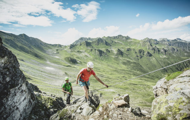
While the mountains may appear wild and inaccessible, they are actually teeming with life.

Poor soils, high UV radiation, significant daily temperature fluctuations, strong winds, and long winters all characterise the mountain environment. While the mountains may appear wild and inaccessible, they are actually teeming with life. This Alpine region, with its lush meadows, rich biodiversity, and warm summer months, provides a unique habitat. A closer examination unveils a fascinating array of organisms that have successfully adapted to these challenging conditions.

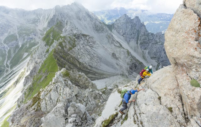
The mountain habitats in Vorarlberg are amongst the last untouched natural areas in the region, supporting a diverse array of animal and plant species. Two-thirds of Vorarlberg’s land area is situated above 1,000 metres in elevation, with rocky habitats accounting for as much as 10% of the total area. This underscores that Vorarlberg is predominantly mountainous, and these habitats play a vital role in the region’s ecosystems. Here, a landscape of contrasts emerges, where living organisms have adapted to a varied living environment.

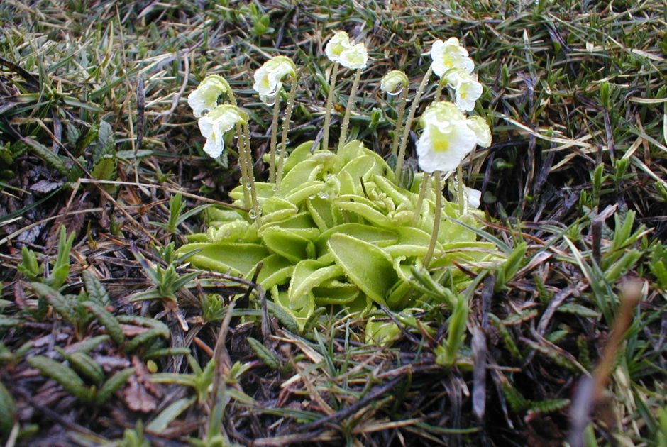
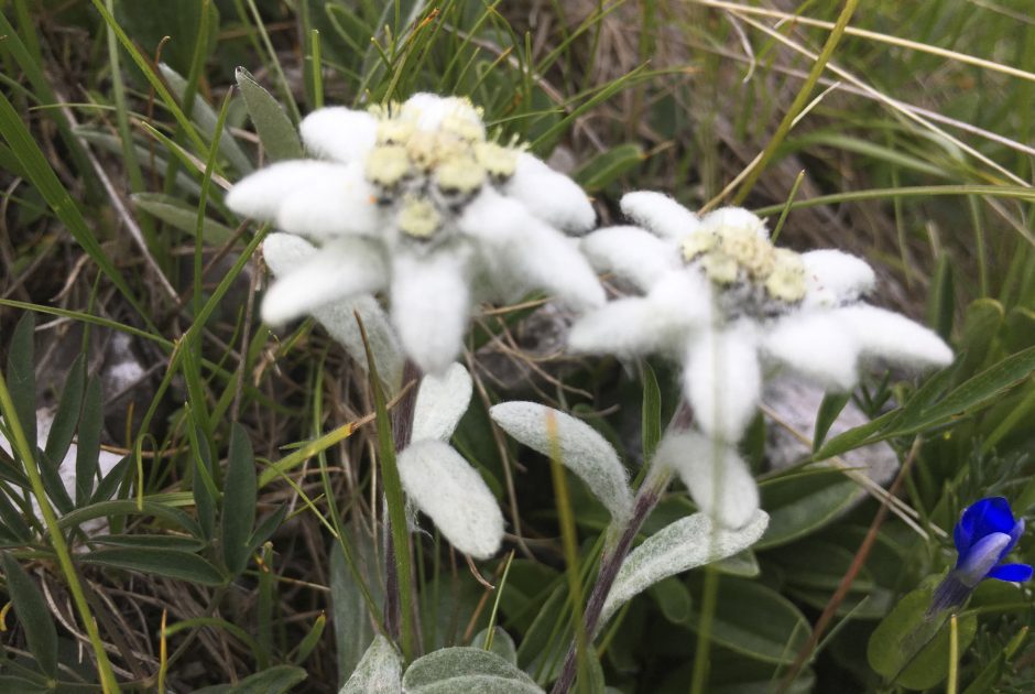
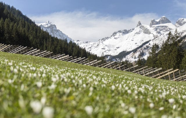
Alpine pasture farming is crucial at elevations between 1,500 and approximately 2,500 metres above sea level, as the diverse mountain meadows in Vorarlberg would not be as extensive without the gentle cultivation practices of past centuries. At higher altitudes, human influence diminishes. Here, rocky landscapes intersperse with mountain grasslands, providing habitats for specialised plants and animals. In this environment, one can encounter Ibexes, Golden Eagles, Edelweiss and Gentian flowers, as well as lesser-known species like the Wallcreeper, the Alpine azalea, and the world’s smallest tree, the Dwarf Willow.

In addition to the ecological factors, the geology of Vorarlberg’s mountains is worth noting. Five geological zones, each with distinct influences on the habitats, extend from south to north. These range from the Silvretta Crystalline in the south to the Northern Limestone Alps, including the Penninic and Helvetic zones, and finally the Molasse zone with its younger rocks in the northern Vorarlberg. This geological diversity serves as a foundation for the rich variety of species found in our mountain habitats, encouraging exploration of nature in Vorarlberg through captivating hikes.

Edelweiss and Cinquefoil
grow the steepest cliffs,
though it's rare to find them,
they are a treasure to behold.

Prof. Georg Grabherr
Nature tips in the mountain habitat
    • Lechweg entlang des Lechbachs

      Lechweg – from the source to the fall (1st…

      This easy long-distance hiking trail is the first section of the 125 km long…

      • 14.28 km

      • 5 h

      • mittel

      Difficulty: mittel
      Distance: 14.28 km
      Ascent: 195 m
      Descent: 629 m
      Duration: 5 h
      Deepest point: 1441 m
      Highest point: 1877 m
      Condition:

      Experience:

      Landscape:

      Lechweg – from the source to the fall (1st stage)

      This easy long-distance hiking trail is the first section of the 125 km long Lechweg.…

      Start of tour

      Bus stop "Formarinsee"

      End of tour

      Lech am Arlberg

      Description

      The first stage of the Lechweg starts at Austria’s most beautiful place in 2015, the lake Formarinsee. From here you hike the first stage of the Lechweg. Along Alpe Formarin, past Gasthaus Älpele, you reach Zug and the fish pond. Now it goes along the Lechuferweg, past a Kneipp facility and barbecue sites back to the starting point of the hike in Lech.

      Best season
      JAN FEB MAR APR MAY JUN
      JUL AUG SEP OCT NOV DEC
      All route info
    • Der Hohe Ifen mit dem typischen Schrattenkalk

      4 days hut-to-hut-tour through Kleinwalsertal

      Four days circular hike for trained and persistent hikers across and around the most…

      • 46.87 km

      • 21.2 h

      • schwer

      Difficulty: schwer
      Distance: 46.87 km
      Ascent: 2468 m
      Descent: 3351 m
      Duration: 21.2 h
      Deepest point: 1019 m
      Highest point: 2222 m
      Condition:

      Experience:

      Landscape:

      4 days hut-to-hut-tour through Kleinwalsertal

      Four days circular hike for trained and persistent hikers across and around the most stunning…

      Start of tour

      Riezlern

      End of tour

      Riezlern

      Description

      From hut to hut the tour takes you around and across the highest peaks in Kleinwalsertal. Each section has unique scenic highlights and is a mountain experience per se: the majestic peaks of the Allgäu Alps are right ahead of you when you hike between Kanzelwand and Mindelheimer hut. The highest peak of the Kleinwalsertal valley, Großer Widderstein, is close by at the highland trail between Gemsteltal and Bärgunttal. After…

      Best season
      JAN FEB MAR APR MAY JUN
      JUL AUG SEP OCT NOV DEC
      All route info
    • Die MTB-Transalp führt vorbei am Formarinsee und der Freiburger Hütte

      Alpencross through Vorarlberg | Klostertal

      This popular Transalp route takes experienced Transalp mountain bikers from Oberstdorf all the way…

      • 80.78 km

      • 12 h

      • schwer

      Difficulty: schwer
      Distance: 80.78 km
      Ascent: 2641 m
      Descent: 2547 m
      Duration: 12 h
      Deepest point: 843 m
      Highest point: 2308 m
      Condition:

      Experience:

      Landscape:

      Alpencross through Vorarlberg | Klostertal

      This popular Transalp route takes experienced Transalp mountain bikers from Oberstdorf all the way down…

      Start of tour

      Warth centre

      End of tour

      Village center, Galtür

      Description

      The Transalp route from Oberstdorf to Lake Garda leads in stages through the eastern part of Vorarlberg. Bikers arrive in Warth via the Schrofenpass. Via Lech, Dalaas and Silbertal you ride to the Heilbronner Hütte and on to Galtür.

      From Warth, follow the road towards Lech. In the centre of Lech, turn right towards Zug. From Zug through the Zuger valley in the direction of Formarinsee. Continue straight on…

      Best season
      JAN FEB MAR APR MAY JUN
      JUL AUG SEP OCT NOV DEC
      All route info
    • .jpg.jpeg

      Around the Kansifluh

      The tour around the Kanisfluh is a classic in the Bregenzerwald.. The route starts…

      • 43.47 km

      • 6 h

      • mittel

      Difficulty: mittel
      Distance: 43.47 km
      Ascent: 1340 m
      Descent: 1340 m
      Duration: 6 h
      Deepest point: 689 m
      Highest point: 1610 m
      Condition:

      Experience:

      Landscape:

      Around the Kansifluh

      Start of tour

      Tourist Office Au

      End of tour

      Tourist Office Au

      Description

      The tour around the Kanisfluh is a classic in the Bregenzerwald.. The route starts in Mellau and continues along the cycle path to Au. That’s where the ascent heading towards Damüls begins and carries on to Berggasthaus Edelweiss at Öberle, which is an inn that is beautifully situated at the foot of the Kanisfluh. The route then continues through the Wurzachalpe and the Kanisalpe to the Rossstelle, where the Mellaubahn…

      Best season
      JAN FEB MAR APR MAY JUN
      JUL AUG SEP OCT NOV DEC
      All route info
    • Blick von etwas oberhalb der Lünerkrinne auf den Lünersee

      Lünersee circuit with variant Lünerkrinne | Brand

      This variant leads over the Lünerkrinne around the Lünersee.

      • 6.89 km

      • 1.3 h

      • mittel

      Difficulty: mittel
      Distance: 6.89 km
      Ascent: 289 m
      Descent: 289 m
      Duration: 1.3 h
      Deepest point: 1965 m
      Highest point: 2159 m
      Condition:

      Experience:

      Landscape:

      Lünersee circuit with variant Lünerkrinne | Brand

      This variant leads over the Lünerkrinne around the Lünersee.

      Start of tour

      Mountain station Lünerseebahn

      End of tour

      Mountain station Lünerseebahn

      Description

      After the ascent with the Lünersee cable car, the trail starts directly at the mountain station. The Lünersee loop runs on the classic Lünersee circular trail once around the lake. In the last third, the trail branches off towards Lünerkrinne and makes a loop up there. On the other side, the trail leads back down to the Lünersee. Continue on the Lünersee circular trail again. If this tour is too…

      Best season
      JAN FEB MAR APR MAY JUN
      JUL AUG SEP OCT NOV DEC
      All route info
    • Malerischer Lünersee

      From the Lünersee to the Lindauer Hütte | Brand…

      Mountain tour with breathtaking mountain scenery past the picturesque Lünersee to the Lindauer Hütte…

      • 22.87 km

      • 8.8 h

      • mittel

      Difficulty: mittel
      Distance: 22.87 km
      Ascent: 1411 m
      Descent: 1480 m
      Duration: 8.8 h
      Deepest point: 994 m
      Highest point: 2331 m
      Condition:

      Experience:

      Landscape:

      From the Lünersee to the Lindauer Hütte | Brand – Latschau/Tschagguns

      Mountain tour with breathtaking mountain scenery past the picturesque Lünersee to the Lindauer Hütte in…

      Start of tour

      Innertal, Brand

      End of tour

      Latschau, Tschagguns or Vandans

      Description

      A footpath leads from Brand to the Lünersee cable car valley station. From there, a steep ascent (partly a secured climb) over the Böser Tritt to the Douglass hut. With the Landbus line 580 and the Lünersee cable car you already gain altitude comfortably and save the first 3.5 hours of the tour – start at the mountain station of the Lünersee cable car.

      From the mountain station of…

      Best season
      JAN FEB MAR APR MAY JUN
      JUL AUG SEP OCT NOV DEC
      All route info
    • Blumenwiese im Bregenzerwald

      Damüls | Altitude loop

      In impressive mountain scenery to the Hochblanken and mountain hut Ragaz.

      • 11.13 km

      • 4 h

      • mittel

      Difficulty: mittel
      Distance: 11.13 km
      Ascent: 361 m
      Descent: 815 m
      Duration: 4 h
      Deepest point: 1370 m
      Highest point: 2068 m
      Condition:

      Experience:

      Landscape:

      Damüls | Altitude loop

      In impressive mountain scenery to the Hochblanken and mountain hut Ragaz.

      Start of tour

      Valley station Ugalift, Damüls

      End of tour

      Valley station Ugalift, Damüls

      Description

      The day of hiking commences with a leisurely trip by chair lift to the Uga mountain station. Then follow the signpost towards Hochblanken. Staying on the signposted path to the right of the ‘Hohes Licht’ lift, you’ll hike uphill to reach a narrow, somewhat steep mountain hiking trail that will take you up to the summit of the Hochblanken. Enjoy magnificent views of the surrounding mountain world at an altitude…

      Best season
      JAN FEB MAR APR MAY JUN
      JUL AUG SEP OCT NOV DEC
      All route info
    • Damülser Mittagspitze im Winter

      Damüls | Circular hike from peak to peak

      Magnificent circular hike at over 1,400 m altitude with a unique mountain panorama.

      • 7.97 km

      • 3 h

      • leicht

      Difficulty: leicht
      Distance: 7.97 km
      Ascent: 290 m
      Descent: 290 m
      Duration: 3 h
      Deepest point: 1404 m
      Highest point: 1702 m
      Condition:

      Experience:

      Landscape:

      Damüls | Circular hike from peak to peak

      Magnificent circular hike at over 1,400 m altitude with a unique mountain panorama.

      Start of tour

      Damüls, city center

      End of tour

      Damüls, City center

      Description

      From Damüls (1,425 m) you walk on the sidewalk in the direction of Oberdamüls and after the Gasthaus Glöckle continue on the well prepared path next to the cross-country trail to Unterdamüls. Then uphill to the Gasthaus Jägerstüble (1,614 m). A high path leads up to approx. 1,700 m (great views to the Rätikon mountain), past the Oberdamülser Alpe (1,667 m) to Oberdamüls. From the Hotel Alpenstern you walk along…

      Best season
      JAN FEB MAR APR MAY JUN
      JUL AUG SEP OCT NOV DEC
      All route info
    • Ausblick in Damüls

      Damüls | Damüls circular tour

      Very attractive hike in the mountains of the Bregenzerwald.

      • 10.9 km

      • 4 h

      • leicht

      Difficulty: leicht
      Distance: 10.9 km
      Ascent: 430 m
      Descent: 860 m
      Duration: 4 h
      Deepest point: 1373 m
      Highest point: 2037 m
      Condition:

      Experience:

      Landscape:

      Damüls | Damüls circular tour

      Very attractive hike in the mountains of the Bregenzerwald.

      Start of tour

      Damüls cable car station

      End of tour

      Damüls cable car station

      Description

      The “Damüls circular tour”commences at the Uga chair lift mountain station and comprises two peaks – after about one and a quarterhours, you reach the Hochblanken and hike along the mountain ridge as far as the Ragazer Blanken. From the Sünser Joch, you cross the “Seven hills” to reach Damüls.

      Best season
      JAN FEB MAR APR MAY JUN
      JUL AUG SEP OCT NOV DEC
      All route info
    • Am Gipfel der Mondspitze. Rund 1.400 Meter unterhalb breitet sich die Alpenstadt Bludenz aus, das Klostertal schlängelt sich Richtung Arlbergpass.

      Panoramic hike Mondspitze and Schillerkopf

      Above valleys, on top of mountains and on Schiller's nose

      Two unequal neighbors tower…

      • 10.6 km

      • 5 h

      • schwer

      Difficulty: schwer
      Distance: 10.6 km
      Ascent: 820 m
      Descent: 820 m
      Duration: 5 h
      Deepest point: 1224 m
      Highest point: 1991 m
      Condition:

      Experience:

      Landscape:

      Panoramic hike Mondspitze and Schillerkopf

      Above valleys, on top of mountains and on Schiller's nose

      Two unequal neighbors tower above…

      Description

      An alpine town lying virtually at the feet of the two summits, directly above the point where five valleys converge, and a 360-degree panorama: Could a panoramic hike offer even more? The highlights of the peak round trip, beginning on the quaint Tschengla high plateau, past alpine pastures, across saddles and through charming meadows and forests, are indeed hard to top. And there are also one or two challenges awaiting…

      Best season
      JAN FEB MAR APR MAY JUN
      JUL AUG SEP OCT NOV DEC
      All route info
    • Gratwanderung Hammerspitze

      3 summit tour from the Kanzelwand to the Fiderepass

      High alpine ridge hike through jagged rocks – three peaks in one day. From…

      • 9.68 km

      • 6 h

      • schwer

      Difficulty: schwer
      Distance: 9.68 km
      Ascent: 527 m
      Descent: 1338 m
      Duration: 6 h
      Deepest point: 1136 m
      Highest point: 2251 m
      Condition:

      Experience:

      Landscape:

      3 summit tour from the Kanzelwand to the Fiderepass

      High alpine ridge hike through jagged rocks – three peaks in one day. From the…

      Start of tour

      Riezlern

      End of tour

      Mittelberg

      Description

      During this tour you climb three peaks: The Walser Hammerspitze, the Hochgehrenspitze and the Oberstdorfer Hammerspitze. Over a jagged, craggy ridge, right at the Austrian-German border, the trail leads you from Kanzelwand lift to the Fiderepasshütte. The first longer ascent may therefore be overcome quite easily by the lift (chargeable). The partially exposed path over the ridge is however only recommended for very sure-footed hikers free from giddiness.

      Best season
      JAN FEB MAR APR MAY JUN
      JUL AUG SEP OCT NOV DEC
      All route info
    • Auf der Forstraße Richtung Alpe Laguz

      Around the Breithorn | Raggal-Marul

      From alp to alp by mountain bike and the simultaneous circumnavigation of the center…

      • 31.64 km

      • 4.5 h

      • schwer

      Difficulty: schwer
      Distance: 31.64 km
      Ascent: 1359 m
      Descent: 1360 m
      Duration: 4.5 h
      Deepest point: 962 m
      Highest point: 1845 m
      Condition:

      Experience:

      Landscape:

      Around the Breithorn | Raggal-Marul

      From alp to alp by mountain bike and the simultaneous circumnavigation of the center of…

      Start of tour

      Hiker's parking lot Marul, Raggal

      End of tour

      Hiker's parking lot Marul, Raggal

      Description

      The MTB tour starts in Marul at the hikers’ car park. From here the route leads along the forest road past the hamlets of Hof and Garfülla, further through the Fuchswald forest to Alpe Laguz. Shortly before Alpe Laguz, the MTB trail branches off to the left towards Garmil. From Garmil, take the forest road down past the Oberpartnom and Unterpartnom alpine huts to Steinbild. From there, continue along the…

      Best season
      JAN FEB MAR APR MAY JUN
      JUL AUG SEP OCT NOV DEC
      All route info
    • Körbersee

      Bike & Hike Körbersee

      In Warth at the village square you start in the direction to the plot…

      • 16.46 km

      • 2.3 h

      • mittel

      Difficulty: mittel
      Distance: 16.46 km
      Ascent: 478 m
      Descent: 706 m
      Duration: 2.3 h
      Deepest point: 1261 m
      Highest point: 1796 m
      Condition:

      Experience:

      Landscape:

      Bike & Hike Körbersee

      In Warth at the village square you start in the direction to the plot Wolfegg,…

      Start of tour

      Village square Warth/Village square Schröcken

      End of tour

      Village square Warth/Village square Schröcken

      Description

      Touring.

      Bike: Village square Warth – Plot Wolfegg – Alte Salzstraße – Jägeralpe – Hochtannbergpass – Salobersattel – Auenfeld

      Hike: Auenfeld – Körbersee – Auenfeld

      Bike: Auenfeld – Village square Schröcken

      or

      Bike: Village square Schröcken – Auenfeld

      Hike: Auenfeld – Körbersee – Auenfeld

      Bike: Auenfeld – Salobersattel – Hochtannbergpass – Jägeralpe – Alte Salzstraße – Plot Wolfegg – Village square Warth

      Best season
      JAN FEB MAR APR MAY JUN
      JUL AUG SEP OCT NOV DEC
      All route info
    • Lechweg

      Bike & Hike Rote Wand (2.704 m)

      From the centre of Schröcken, take the wide gravel road up to Auenfeld. Via…

      • 48.87 km

      • 7.4 h

      • schwer

      Difficulty: schwer
      Distance: 48.87 km
      Ascent: 1993 m
      Descent: 1806 m
      Duration: 7.4 h
      Deepest point: 1261 m
      Highest point: 2638 m
      Condition:

      Experience:

      Landscape:

      Bike & Hike Rote Wand (2.704 m)

      From the centre of Schröcken, take the wide gravel road up to Auenfeld. Via the…

      Start of tour

      Village square Warth/Village square Schröcken

      End of tour

      Village square Warth/Village square Schröcken

      Description

      Touring.

      Bike: Village square Schröcken – Auenfeld – Auenfeldsattel – Oberlech – Lech – Zug – Formarinsee

      Hike: Formarinsee – Rote Wand – Formarinsee

      Bike: Formarinsee – Zug – Lech – by bus to Warth-Schröcken

      or

      Bike: Village square Warth – Plot Wolfegg – Alte Salzstraße – Hochtannbergpass – Salobersattel – Auenfeld – Auenfeldsattel – Oberlech – Lech – Zug – Formarinsee

      Hike: Formarinsee – Rote Wand – Formarinsee

      Best season
      JAN FEB MAR APR MAY JUN
      JUL AUG SEP OCT NOV DEC
      All route info
    • Auf dem Weg zur Winterstaude

      Bezau | Winterstaude

      A quite difficult hike from the mountain station of Bezau cable car to the…

      • 9.35 km

      • 3.8 h

      • mittel

      Difficulty: mittel
      Distance: 9.35 km
      Ascent: 330 m
      Descent: 760 m
      Duration: 3.8 h
      Deepest point: 1207 m
      Highest point: 1877 m
      Condition:

      Experience:

      Landscape:

      Bezau | Winterstaude

      A quite difficult hike from the mountain station of Bezau cable car to the Winterstaude…

      Start of tour

      Baumgarten cable car station

      End of tour

      Sonderdach cable car station

      Description

      On the mountain ridge “Niedere”, you follow a path as far as Stongerhöhe, enjoying lovely views all the while. A steep alpine track then takes you across the “Hasenstrick” to the summit of the Winterstaude. Several picturesque alps with their own alpine dairies are located along the downwards path. You return to the valley in comfort – via cable car from Sonderdach middle station.

      Best season
      JAN FEB MAR APR MAY JUN
      JUL AUG SEP OCT NOV DEC
      All route info

This may also be of interest