Sie haben Javascript deaktiviert. Bitte aktivieren Sie Javascript damit die Seite verwendet werden kann.

Webcams Current Snow Report Avalanche Report Weather & Traffic
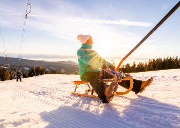
Rodelsafari im Brandnertal, toboggan (c) Dietmar Walser / Alpenregion Bludenz Tourismus
Into the valley on two runners

Tobogganing in Vorarlberg

Fun in the snow

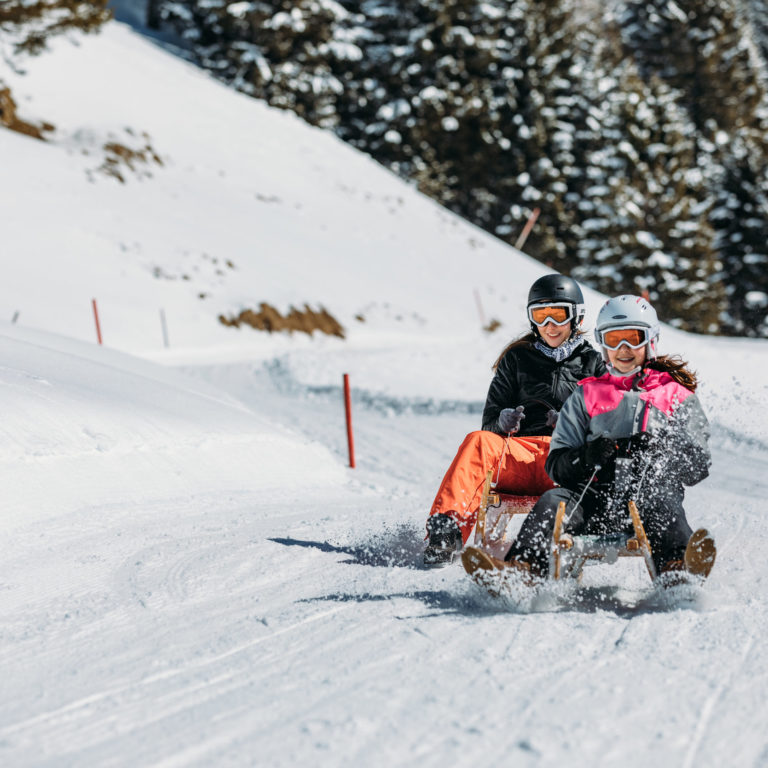
Select from countless sledging tracks or toboggan runs located throughout the Vorarlberg holiday region. Some tracks are even floodlit or illuminated by torchlight. The longest such track is the 5.5-km-long night-sledging track in St. Gallenkirch-Garfrescha in Montafon. Before sledging down, it is important to gather your courage and strength at one of the mountain huts or inns near the sledging tracks. Those without a sledge can rent one at many places.

Special Tip: In the Brandnertal there is a toboggan safari, which allows you to enjoy the snowy landscape and breathtaking views during between the fast descents. It leads  from the top station of the Panoramabahn down to Bürserberg, back to the starting point by bus. On Tuesdays, an evening toboggan safari is organised, with participants sporting headlamps as they whizz down the trail. There is always a guide to accompany the party.

Play
Tobogganing fun in Vorarlberg
  • Use Ctrl + scrollwheel to zoom
    • Radfahren im Vorsäß Enge in Mellau

      Bezau | Bezau – Schnepfegg – Bizau – Bezau

      Bezau - Mellau - Schnepfau - Schnepfegg - Bizau - Hilkat - Seevorsäß -…

      • 22.55 km

      • 1.5 h

      • mittel

      Difficulty: mittel
      Distance: 22.55 km
      Ascent: 827 m
      Descent: 820 m
      Duration: 1.5 h
      Deepest point: 635 m
      Highest point: 897 m
      Condition:

      Experience:

      Landscape:

      Bezau | Bezau – Schnepfegg – Bizau – Bezau

      Bezau - Mellau - Schnepfau - Schnepfegg - Bizau - Hilkat - Seevorsäß - Bezau

      Description

      Bezau – Mellau – Schnepfau – Schnepfegg – Bizau – Hilkat – Seevorsäß – Bezau

      Best season
      JAN FEB MAR APR MAY JUN
      JUL AUG SEP OCT NOV DEC
      All route info
    • Seven Summits Tour Schröcken 2019

      Rookie Summits Tour Schröcken

      The route follows hiking trails and is marked with the characteristic Summits markers. Initially,…

      • 19.99 km

      • 8.5 h

      • schwer

      Difficulty: schwer
      Distance: 19.99 km
      Ascent: 1443 m
      Descent: 1429 m
      Duration: 8.5 h
      Deepest point: 1092 m
      Highest point: 2325 m
      Condition:

      Experience:

      Landscape:

      Rookie Summits Tour Schröcken

      The route follows hiking trails and is marked with the characteristic Summits markers. Initially, the…

      Description

      Touring.

      Schröcken municipality – Alpe Felle – towards Hochgletscher – Fürggele – Hochberg – Return to Fürggele – Lagazun – Biberacher Hütte – back to Schröcken via Landsteg

      Best season
      JAN FEB MAR APR MAY JUN
      JUL AUG SEP OCT NOV DEC
      All route info
    • Gravelbiker bei einer Pause in Schwarzenberg

      Bezau | Andelsbuch – Egg – Schwarzenberg – Bezau

      Bezau - Andelsbuch - Egg - Schwarzenberg - Bezau

      • 18.68 km

      • 2 h

      • schwer

      Difficulty: schwer
      Distance: 18.68 km
      Ascent: 366 m
      Descent: 367 m
      Duration: 2 h
      Deepest point: 523 m
      Highest point: 793 m
      Condition:

      Experience:

      Landscape:

      Bezau | Andelsbuch – Egg – Schwarzenberg – Bezau

      Bezau - Andelsbuch - Egg - Schwarzenberg - Bezau

      Description

      Bezau – Andelsbuch – Egg – Schwarzenberg – Bezau

      Best season
      JAN FEB MAR APR MAY JUN
      JUL AUG SEP OCT NOV DEC
      All route info
    • Hochkrumbach, Weltfriedenskreuz am Simmel

      Warth large Karhorn circuit

      Via our well-known Simmel, the route leads to our popular Körbersee mountain lake, continuing…

      • 20.34 km

      • 7.3 h

      • mittel

      Difficulty: mittel
      Distance: 20.34 km
      Ascent: 1027 m
      Descent: 1027 m
      Duration: 7.3 h
      Deepest point: 1438 m
      Highest point: 2207 m
      Condition:

      Experience:

      Landscape:

      Warth large Karhorn circuit

      Via our well-known Simmel, the route leads to our popular Körbersee mountain lake, continuing under…

      Description

      – Distance: 20.3 km

      – Duration: 4:20 h

      – Ascent: 1,027 vertical meters

      – Descent: 1,027 vertical meters

      – Highest point: 2,207 vertical meters

      – Lowest point: 1,438 vertical meters

      – Asphalt content < 7%

      Best season
      JAN FEB MAR APR MAY JUN
      JUL AUG SEP OCT NOV DEC
      All route info
    • Bürstegg

      Warth – Bürstegg with panoramic lake

      Along the Lech river, past the highest Walser settlement in Vorarlberg (Bürstegg ) and…

      • 19.92 km

      • 4.3 h

      • leicht

      Difficulty: leicht
      Distance: 19.92 km
      Ascent: 947 m
      Descent: 947 m
      Duration: 4.3 h
      Deepest point: 1315 m
      Highest point: 2055 m
      Condition:

      Experience:

      Landscape:

      Warth – Bürstegg with panoramic lake

      Along the Lech river, past the highest Walser settlement in Vorarlberg (Bürstegg ) and finally…

      Description

      – Distance: 19.9 km

      – Duration: 4:00 to 5:00 h

      – Ascent: 976 vertical meters

      – Descent: 976 vertical meters

      – Highest point: 2,056 vertical meters

      – Lowest point: 1,315 vertical meters

      – Asphalt share: < 1 %

      Best season
      JAN FEB MAR APR MAY JUN
      JUL AUG SEP OCT NOV DEC
      All route info
    preloader