Sie haben Javascript deaktiviert. Bitte aktivieren Sie Javascript damit die Seite verwendet werden kann.

Webcams Current Snow Report Avalanche Report Weather & Traffic
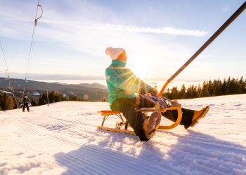
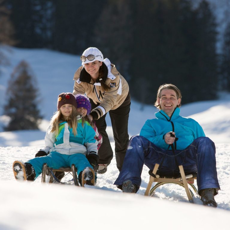
Rodelsafari im Brandnertal, toboggan (c) Dietmar Walser / Alpenregion Bludenz Tourismus
Into the valley on two runners

Tobogganing in Vorarlberg

Fun in the snow

Select from countless sledging tracks or toboggan runs located throughout the Vorarlberg holiday region. Some tracks are even floodlit or illuminated by torchlight. The longest such track is the 5.5-km-long night-sledging track in St. Gallenkirch-Garfrescha in Montafon. Before sledging down, it is important to gather your courage and strength at one of the mountain huts or inns near the sledging tracks. Those without a sledge can rent one at many places.

Special Tip: In the Brandnertal there is a toboggan safari, which allows you to enjoy the snowy landscape and breathtaking views during between the fast descents. It leads  from the top station of the Panoramabahn down to Bürserberg, back to the starting point by bus. On Tuesdays, an evening toboggan safari is organised, with participants sporting headlamps as they whizz down the trail. There is always a guide to accompany the party.

Play
Tobogganing fun in Vorarlberg
  • Use Ctrl + scrollwheel to zoom
    • Winterwandern

      Cross-country circuit Falkenkopf/Körbersee

      Length: 5,7 km | Category: Classical and skating | Difficulty: Heavy | Starting point:…

      • 5.69 km

      • 1.3 h

      • schwer

      Difficulty: schwer
      Distance: 5.69 km
      Ascent: 185 m
      Descent: 185 m
      Duration: 1.3 h
      Deepest point: 1653 m
      Highest point: 1745 m
      Condition:

      Experience:

      Landscape:

      Cross-country circuit Falkenkopf/Körbersee

      Length: 5,7 km | Category: Classical and skating | Difficulty: Heavy | Starting point: Salober…

      Start of tour

      Hochtannbergpass

      End of tour

      Hochtannbergpass

      Description

      Length: 5,7 km | Category: Classical and skating | Difficulty: Heavy | Starting point: Salober valley station

      Best season
      JAN FEB MAR APR MAY JUN
      JUL AUG SEP OCT NOV DEC
      All route info
    • der Ill entlang

      Montafon – Walgau Runde

      Aktivpark Montafon - Tschagguns - Kaltenbrunnen/Gantschier - Vandans - Lorüns - Bludenz - Nüziders…

      • 49.95 km

      • 3.7 h

      • schwer

      Difficulty: schwer
      Distance: 49.95 km
      Ascent: 208 m
      Descent: 208 m
      Duration: 3.7 h
      Deepest point: 500 m
      Highest point: 676 m
      Condition:

      Experience:

      Landscape:

      Montafon – Walgau Runde

      Aktivpark Montafon - Tschagguns - Kaltenbrunnen/Gantschier - Vandans - Lorüns - Bludenz - Nüziders -…

      Description

      Aktivpark Montafon – Tschagguns – Kaltenbrunnen/Gantschier – Vandans – Lorüns – Bludenz – Nüziders – Ludesch – Thüringen – Bludesch – Gais – Nenzing – Nüziders – Bludenz – Lorüns – Vandans – Gantschier/Kaltenbrunnen – Tschagguns – Aktivpark Montafon

      Best season
      JAN FEB MAR APR MAY JUN
      JUL AUG SEP OCT NOV DEC
      All route info
    • Alpkreuz

      Zum Seebligasee

      Kapell Bergstation - Seebligasee - retour Kapell Bergstation

      • 3.12 km

      • 1 h

      • leicht

      Difficulty: leicht
      Distance: 3.12 km
      Ascent: 118 m
      Descent: 118 m
      Duration: 1 h
      Deepest point: 1855 m
      Highest point: 1972 m
      Condition:

      Experience:

      Landscape:

      Zum Seebligasee

      Kapell Bergstation - Seebligasee - retour Kapell Bergstation

      Description

      Kapell Bergstation – Seebligasee – retour Kapell Bergstation

      Best season
      JAN FEB MAR APR MAY JUN
      JUL AUG SEP OCT NOV DEC
      All route info
    • Entlang der Ill in Tschagguns

      City Tour

      • 27.44 km

      • 2 h

      • mittel

      Difficulty: mittel
      Distance: 27.44 km
      Ascent: 141 m
      Descent: 141 m
      Duration: 2 h
      Deepest point: 558 m
      Highest point: 676 m
      Condition:

      Experience:

      Landscape:

      City Tour

      Best season
      JAN FEB MAR APR MAY JUN
      JUL AUG SEP OCT NOV DEC
      All route info
    • Bregenz Bodensee Pipeline

      Leiblachtal Route

      Easy cycle tour from Bregenz along Lake Constance via Lochau and Hörbranz to Hohenweiler. 

      • 13.52 km

      • 1 h

      • leicht

      Difficulty: leicht
      Distance: 13.52 km
      Ascent: 100 m
      Duration: 1 h
      Deepest point: 395 m
      Highest point: 499 m
      Condition:

      Experience:

      Landscape:

      Leiblachtal Route

      Easy cycle tour from Bregenz along Lake Constance via Lochau and Hörbranz to Hohenweiler. 

      Description

      Easy cycle tour from Bregenz along Lake Constance via Lochau and Hörbranz to Hohenweiler. 

      Best season
      JAN FEB MAR APR MAY JUN
      JUL AUG SEP OCT NOV DEC
      All route info
    preloader